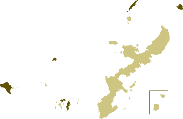
Kume Island Kerama Islands (Tokashiki & Zamami) Aguni Island Iheya Island Yoron Island

Buses also operate on islands around Okinawa Mainland.
On Kume Island, located about 100 km west of Okinawa Mainland, bus service is operated by Kume town office.
In the Kerama Islands, about 30 km west of Okinawa Mainland, bus services are operated by Tokashiki Kanko bus on Tokashiki Island, and by Zamami village office on Zamami Island.
On Aguni Island, about 60 km west of Okinawa Mainland, bus and on-demand taxi service Are operated by Aguni village office.
On Iheya Island, about 40 km northwest of Okinawa Mainland, bus service is operated by Iheya village office.
On Yoron Island in Kagoshima Prefecture, about 30 km north of Okinawa Mainland, bus service is operated by Minami bus.
If the map does not display properly, please view it here. For the map legend, click here.
| No. | Route | Details | Operator | |
|---|---|---|---|---|
| Airport line | Kume island hotel | Kumejima airport |   Time Route Time Route | Kumejima Town |
| Kanegusuku Eef line via Hiyajo | Kanegusuku port terminal-maeo | Eef Joho plaza-mae |   Time Route Time Route | Kumejima Town |
| Kanegusuku Eef line via Kadekari | Kanegusuku port terminal-maeo | Eef Joho plaza-mae |   Time Route Time Route | Kumejima Town |
| Shimajiri line | Eigyosho | Shimajiri |   Time Route Time Route | Kumejima Town |
If the map does not display properly, please view it here. For the map legend, click here.
| No. | Route | Details | Operator | |
|---|---|---|---|---|
| Tokashiki Island | ||||
| - | Tokashiki port | Aharen beach |   Time Route Time Route | Tokashiki Kanko bus |
| Zamami Island | ||||
| - | Ama campjo | Asa Kominkan |   Time Route Time Route | Zamami Village |
If the map does not display properly, please view it here. For the map legend, click here.
| No. | Route | Details | Operator | |
|---|---|---|---|---|
| Anny | Hama Community | Nishi Community |   Time Route Time Route | Aguni Village |
| Rikarika | Demand Taxi Service | Runs across the island as needed |   Time Route Time Route | Aguni Village |
If the map does not display properly, please view it here. For the map legend, click here.
| No. | Route | Details | Operator | |
|---|---|---|---|---|
| - | Dana Kominkan | Sekai Shio-no Hakubutsukan |   Time Route Time Route | Iheya Village |
If the map does not display properly, please view it here. For the map legend, click here.
| No. | Route | Details | Operator | |
|---|---|---|---|---|
| - | Minami bus-mae | Minami bus-mae |   Time Route Time Route | Minami bus |
- Copyright Bus map Okinawa All Rights Reserved. -